+33 (0)1 43 29 87 94 
INFO@HERODOTEBOOKS.COM
Librairie-Galerie HÉRODOTE 
29 rue Guénégaud
75006 Paris
« Je lis de près, je vais aux sources d'origine, je cherche à comprendre et je partage, ou l'amour du savoir humain qui nous rassemble. » JLC
Expertises de collections et estimations gracieuses, confidentielles et en toute sécurité par un libraire-antiquaire expert-conseil agréé.
La qualité et le sérieux de notre travail, régulièrement soulignés par les institutions et les fondations internationales les plus prestigieuses, les collectionneurs majeurs du XXe et XXIe siècle, demeurent notre priorité.
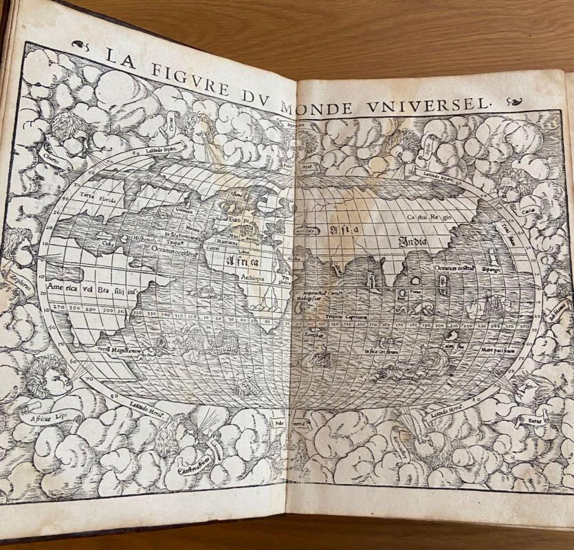
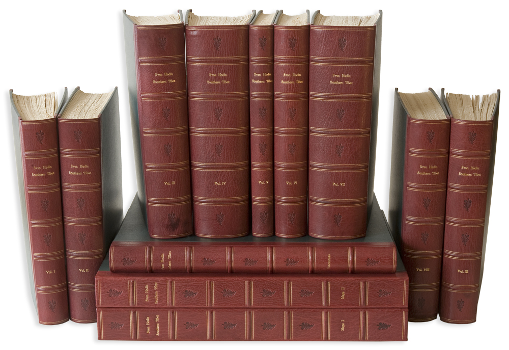
Sven HEDIN. Southern Tibet
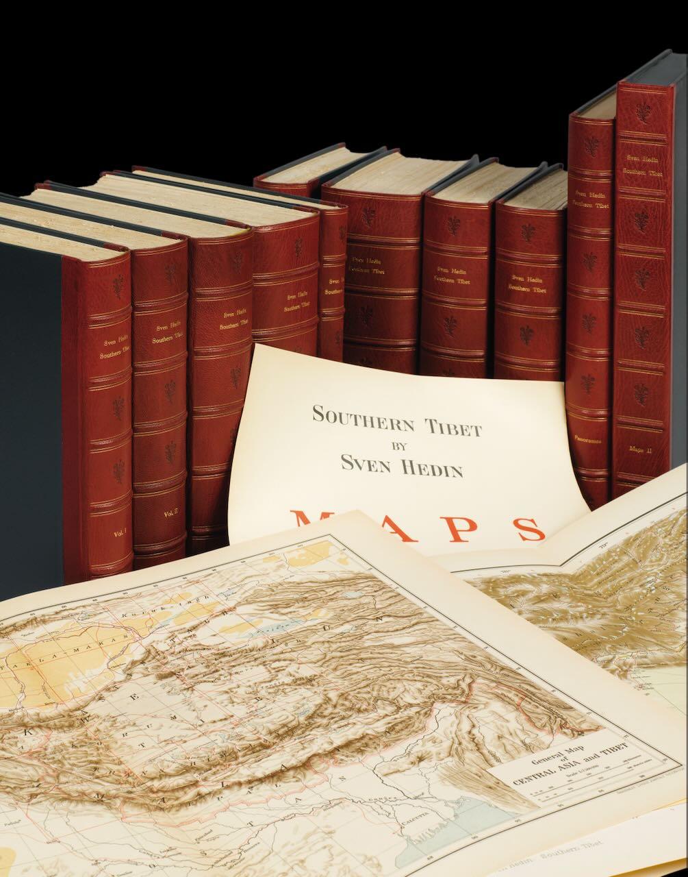
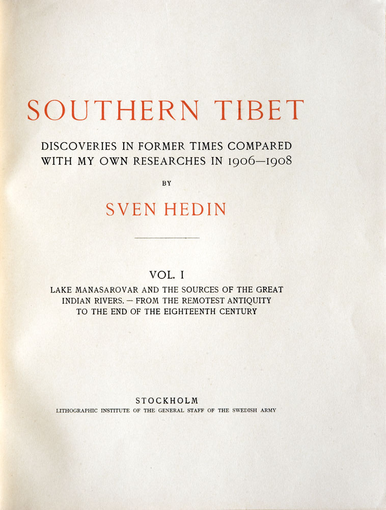
HEDIN (Dr Sven Anders). Southern Tibet
Discoveries in former times compared with my own researches in 1906-1908 by Sven Hedin. [vol. I] Lake Manasarovar and the sources of the great Indian Rivers. – from the remotest antiquity to the end of the eighteenth century. [vol. II] Lake Manasarovar and the sources of the great Indian Rivers. – from the remotest antiquity to the end of the eighteenth century to 1913. [vol. III] Transhimalaya. [vol. IV] Kara-Korum and Chang-Tang. [vol. V] Petrographie und Geologie von prof. Dr Anders Henning. [vol. VI] Part I. Die Meteorologischen Beobachtungen Bearbeitet von prof. Dr Nils Ekholm. Part II. Les Observations Astronomiques calculées et rédigées par le Dr K. G. Olsson. Part III. Botany by prof. Dr C. H. Ostenfeld. [vol. VII] History of exploration in the Kara-Korum Mountains. [vol. VIII] Part I. The Ts’ung-Ling mountains by Sven Hedin and Albert Herrmann. Part II. Die Westlander in der Chinesischen Kartographie von Albert Herrmann. Part III. Zwei Osttürkische Manuskriptkarten unter Mitwirkung von A. V. Le Coq and Albert Herrmann. Part. IV. Chinesische Umschreibungen von Älteren geographischen Namen von A. Herrmann. [vol. IX] Part I. Journeys in eastern Pamir by Sven Hedin. Part II. Osttürkische Namenliste by von A. V. Le Coq. Part III. Zur Geologie von Ost-Pamir (…). Part. IV. Eine Chinesische Beschreibung von Tibet by von Julius Klaproth (…). Part. V. General index.
Stockholm, Lithographic Institute of the General Staff of the Swedish Army, 1917-1922.
28 000 €
9 volumes grands in-4° et 3 atlas in-folio [420 x 320 mm] en deux parties :
1. XXXII-293 pp.-1 reprod. photographique h.-t.-53 cartes h.-t. [I-LIII].
2. XI-330 pp.-81 reprod. photographiques h.-t.-24 cartes h.-t. [I-XXIV].
3. XI-369 pp.-100 reprod. photographiques h.-t.-31 cartes h.-t. [I-XXXI].
4. XII-428 pp.-200 reprod. photographiques h.-t.-33 panoramas coul. h.-t.
5. (2)-220 pp.-60 illust.-18 profils et 7 cartes in et h.-t.
6. (3)-VII-133 pp./(2)-86 pp./X-de la p. 14 à la p. 193-1 f. non ch.-11 planches h.-t. [I-XI].
7. X-(1)-605 pp.-21 reprod. photographiques h.-t.-103 cartes h.-t. [I-CIII].
8. XVI-456 pp.-45 cartes h.-t. [I-XXIX].
9. VII-180 pp./131 p./176 pp.-29 planches h.-t.-3 cartes h.-t.
Les atlas se composent ainsi :
1. Atlas of Tibetan Panoramas ; faux titre-page de grand titre-10 pp. [table]-105 pl. doubles [1-105].
2. Maps I ; page de grand titre-Index map-General map of Central Asia-15 pl. doubles [General map of East Turkestan : I-XV]-26 pl. doubles [Special map of Sven Hedin’s route : 1-26]-2 pl. doubles non ch. [General map]- 2 pl. doubles [Map of Sven Hedin’s travels : I-II].
3. Maps II ; Hypsometrical Maps by Colonel H. Byström-page de grand titre-Index map-52 pl. doubles [1-52].
Une demi-basane prune à petits coins, dos à nerfs, filets or perlés, fleurons à froid, titre or, une reliure uniforme moderne, un bel exemplaire.
BIBLIOGRAPHIE
Édition originale complète.
– Hess, t. I, pp. 49-51 ; – Marshall, Britain and Tibet, 1765-1947, 2096 ; – Yakushi, Catalogue of the Himalayan Literature, H 179.